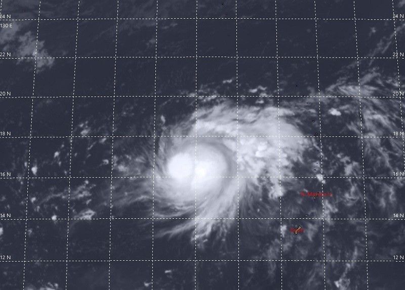
Tropical storm Rolly with the international name “Goni” is slowly entering the Philippine area of responsibility (PAR).
According to Pagasa, the outer portion of the typhoon is already inside our ocean.
But it may be this afternoon that it will be able to fully enter the PAR, due to the extent of circulation.
TS Rolly was last seen more than 1,000 km east of Central Luzon.
It has a power of 65 kph and a gust of 80 kph.
It is moving slowly in a northwest direction.
It is still a mystery where its first landfall will be directly affected, as local and international weather agencies have different estimates.
According to Pagasa data, it is said to hit directly in Catanduanes, before penetrating the Camarines provinces and exiting the Batangas area.
For the Japan Meteorological Agency (JMA), it will only hit Bicol and may be the first landfall on Polilio Island in Quezon province.
While at the Joint Typhoon Warning Center (JTWC) of the USA, it will not hit the Bicol region and instead Polilio Island and Aurora are likely to be hit by the typhoon.


